Newsletters
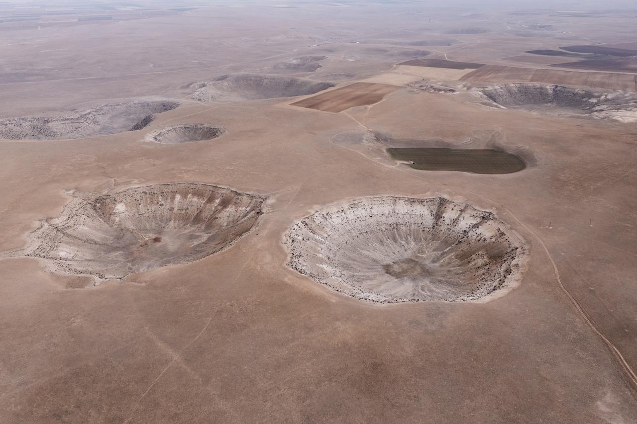


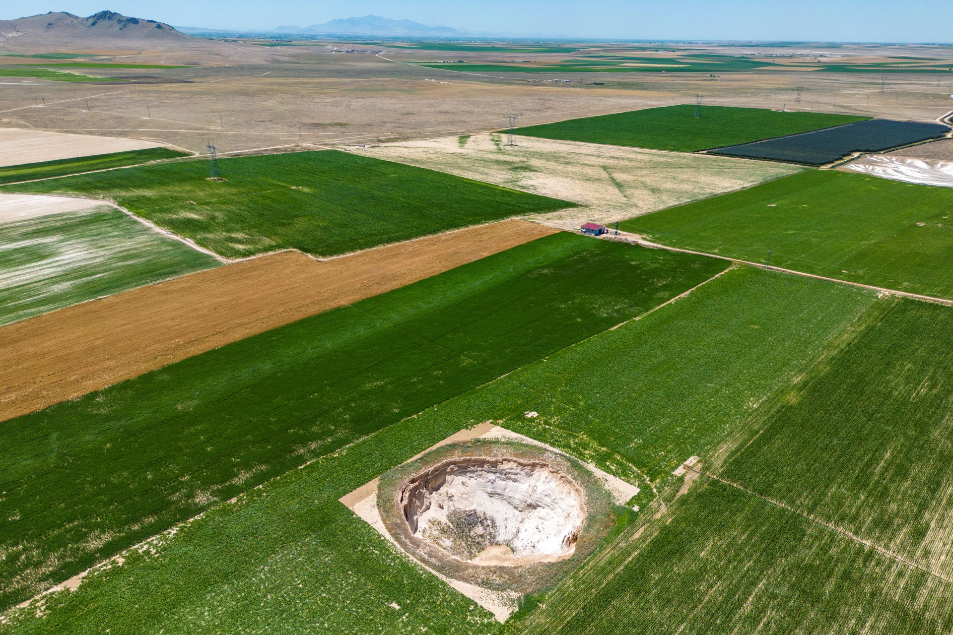
A new assessment by the Disaster and Emergency Management Authority (AFAD) has documented 684 sinkholes across Konya, Karaman and Aksaray, offering the most comprehensive picture to date of how climate change, prolonged drought and uncontrolled groundwater use are reshaping the Konya Closed Basin. The latest figure marks a continued rise in formations that have long troubled the region and prompted national risk-mapping efforts.

Authorities note that the Konya Plain has seen a steady expansion in the number of sinkholes as groundwater levels fall, pushing the land surface to sag or collapse. AFAD’s earlier work identified 655 sinkholes in Konya alone, and the newer phase of the project confirms that the overall impact now stretches well beyond provincial borders.
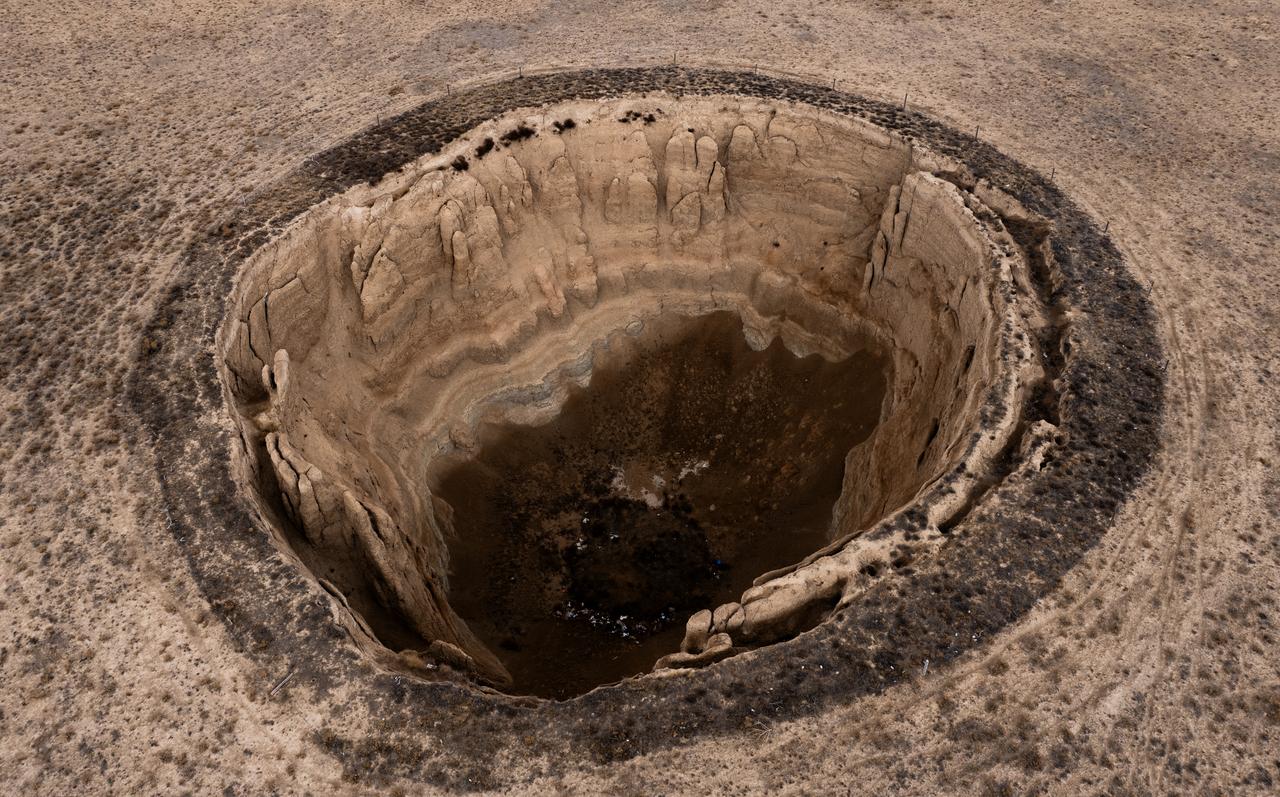
According to AFAD’s classification based on formation mechanisms, 331 of Konya’s sinkholes fall into what specialists describe as “cover collapse,” a type that involves sudden and often deeper collapses. Another 273 relate to “cover subsidence,” where the ground gradually sinks over time, while 51 were linked to failures in the underlying bedrock.
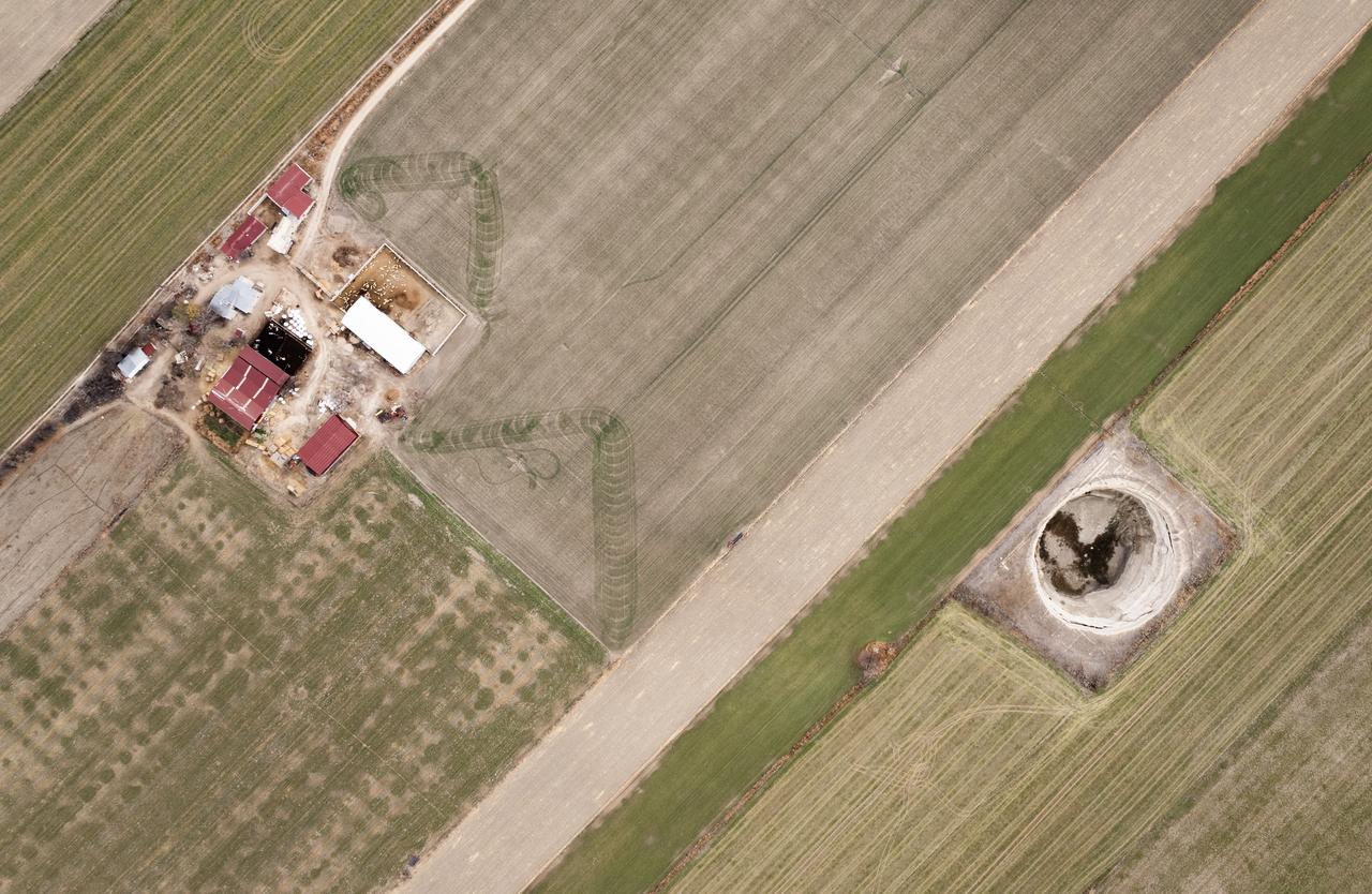
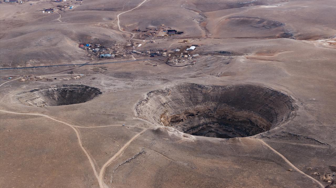
The concentration of sinkholes is not uniform. AFAD’s mapping shows that 534 of Konya’s formations lie within Karapinar district, with others scattered across Cihanbeyli, Cumra, Karatay, Akoren, Selcuklu, Celtik, Sarayonu, Kadinhani, Altinekin, Ilgin and Eregli.
The expanded survey also recorded 20 sinkholes in Karaman and nine in Aksaray, bringing the regional total to 684.
Ali Ihsan Korpes, AFAD’s provincial director in Konya, explained that the institution has been working to produce vulnerability maps for different hazard types across Türkiye. He pointed to avalanche sensitivity maps in Van and landslide maps in Rize as part of the same approach.
Korpes said the first phase of the Konya Closed Basin study, completed between 2020 and 2023, enabled authorities to build a detailed Sinkhole Sensitivity Map. He added that efforts focus on formations with the potential to cause damage. The second phase, which began this year, broadens the study area and relies on a digital system that allows personnel to record coordinates on-site and transmit data directly to the center.

Korpes stressed that all recorded sinkholes lie in rural or agricultural areas and that “no sinkhole threatening a settlement has been identified.” He also noted that there has been no incident involving danger to residents so far, while work continues to strengthen preparedness.
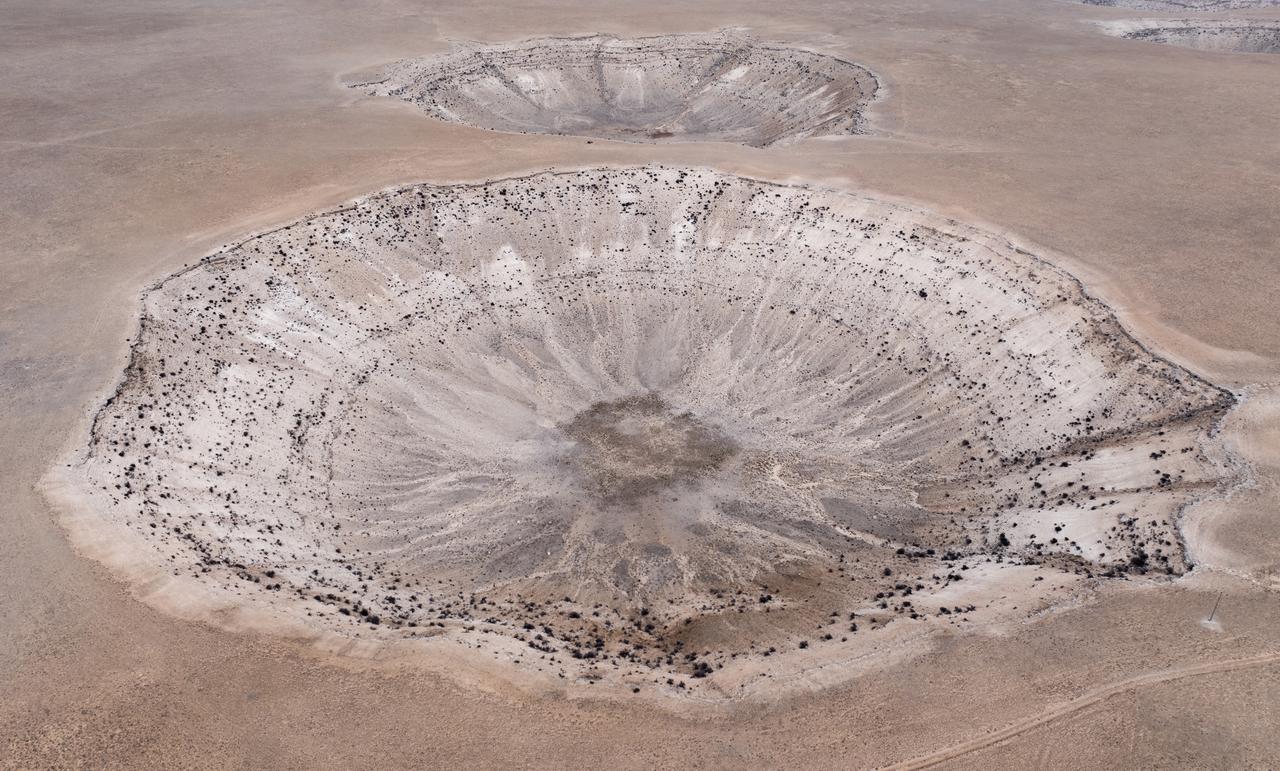
Experts recognize eight global classes of sinkholes. Korpes highlighted that “cover collapse” formations receive greater attention because they tend to be wider and deeper, and such examples appear in parts of Karapinar.
The region also exhibits what specialists describe as “sagging sinkholes,” though other classifications remain within the domain of academic research. The AFAD team evaluates criteria such as depth and diameter during its fieldwork.


 2 min read
 1 min read