Newsletters
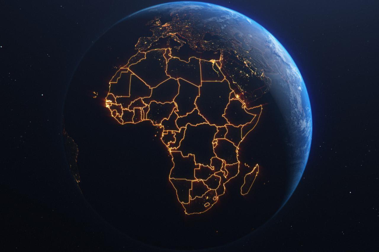


The African Union, a continental body of 55 countries, backed last week a campaign to correct the representation of Africa on world maps.
The Union is calling on governments and international organizations to replace the 16th-century Mercator world map with versions that show the continent’s actual dimensions.
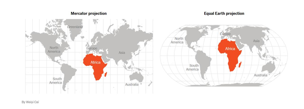

According to the campaign, Africa, the world’s second-largest continent, appears much smaller than it actually is on the most commonly used world map.
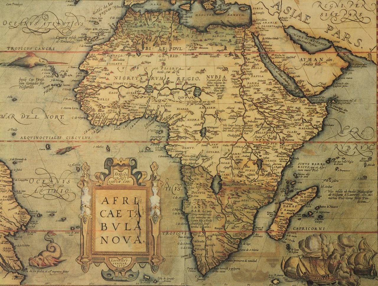
This distortion stems from the 16th-century map by Flemish geographer Gerardus Mercator, which enlarges Europe and North America while halving Africa’s size.
While useful for navigation in its time, the Mercator projection distorts area sizes.
The initiative aims to address Africa’s “colonial scaling,” as common maps—including those in textbooks and digital applications—significantly underrepresent the continent’s true size.
Supporters see the campaign going beyond correcting a geographical image.
They see it as part of a broader effort to restore Africa’s standing in global consciousness.
According to the campaign, correcting the map is a “symbolic act that reshapes the narrative about Africa” and addresses centuries of distorted representation.
The campaign argues that the Mercator map was drafted to help European explorers navigate the seas more easily but ended up warping landmasses as a result.
“It might seem to be just a map, but in reality, it is not,” Selma Malika Haddadi, the deputy chairwoman of the African Union’s executive arm, said this week in an interview with Reuters.
The Mercator projection fosters a false impression that Africa is “marginal,” she said.
Opponents of the Mercator map are turning to alternatives such as the Equal Earth projection.
Introduced in 2018, the Equal Earth projection is a new equal-area pseudocylindrical map designed to represent the world more accurately.
Its developers aimed to show developing countries in the tropics and developed countries in the north with correct proportional sizes.
The projection has been widely welcomed by those seeking an alternative to the traditional world map, particularly for its accurate depiction of Africa’s true size.
French lawmaker Rima Hassan, a member of the La France Insoumise party in the European Parliament, has declared her support for the “Correct the Map” campaign launched by African organizations with backing from the African Union.
The initiative seeks to reconsider how continents are represented on world maps.
Rima Hassan, known for her stance against Western dominance, wrote on X: “Yes, yes, and yes,” in a clear show of support for correcting Africa’s size on world maps.
She stressed that the move goes beyond a technical adjustment, touching on the very core of the global narrative about Africa.
Supporters of the Mercator map argue that it was a practical navigation tool, not a colonial weapon.
The Mercator projection, invented in 1569, allowed sailors to plot straight-line paths—known as rhumb lines—which was a major advance in 16th-century navigation.
English mathematician Edward Wright refined it about 30 years later, making it more accurate and usable.
While other projections, such as Equal Earth or Gall-Peters, better preserve land area, they often distort shapes or overall appearance.
Modern cartographers frequently combine different projections to balance accuracy in size and shape.
Supporters emphasize that the Mercator projection’s distortions are technical rather than political, and using it does not amount to deliberate marginalization of any region.


 10 min read