Newsletters


Scientists have uncovered compelling evidence that the African continent is gradually dividing into two distinct landmasses, a process that has been underway for tens of millions of years. Researchers at Keele University have analyzed historical magnetic data, revealing that the separation between Africa and Arabia began far earlier than previously understood.
Once united like the pieces of a puzzle, Africa and Arabia are now drifting apart from northeast to south in a movement likened to a “slowly unzipping zipper.” The rifting process is accompanied by significant volcanic activity and seismic movements. Experts predict that within the next 5 million to 10 million years, Africa could take on the appearance of two separate continents.
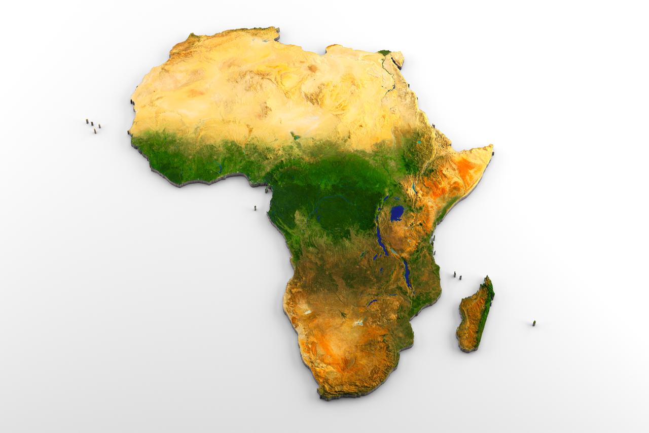
According to the new findings, the western portion of the continent will include countries such as Egypt, Algeria, Nigeria, Ghana and Namibia, forming a larger landmass. Meanwhile, the eastern block, encompassing much of Somalia, Kenya, Tanzania, Mozambique, and Ethiopia, will constitute a smaller continental segment.
Professor Peter Styles, a geologist at Keele University, emphasized the importance of the study, stating, “This research provides a crucial window into the ongoing dynamics of Earth’s surface.”
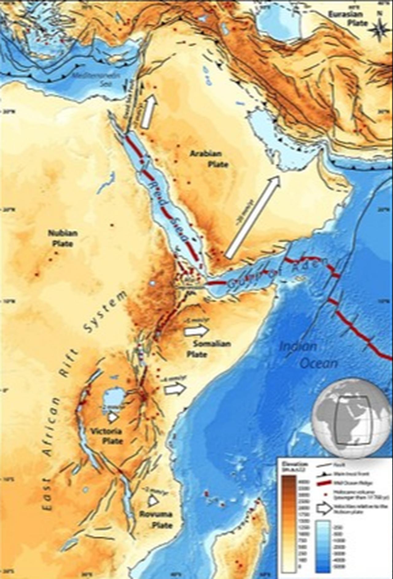

The research team focused on the Afar region, home to the East African Rift, by digitizing magnetic data collected in 1968 and 1969. Using modern analytical techniques, the team combined these data with historical measurements from the Red Sea and the Gulf of Aden.
According to the theory of plate tectonics, present-day continents were once parts of vastly different supercontinents. Over millions of years, tectonic plates have drifted apart, creating new oceanic crust and forming seas in a process known as seafloor spreading.
The East African Rift, stretching approximately 4,000 kilometers from Jordan through East Africa to Mozambique, represents one of the clearest examples of this ongoing continental breakup. Scientists suggest that the future division of Africa will follow this rift, potentially cutting through Lake Malawi and Lake Turkana.
The Afar region is one of the few places on Earth where three tectonic rifts converge: the Ethiopian Rift, the Red Sea Rift and the Gulf of Aden Rift. Researchers note that the earliest stages of continental separation can be observed in this region. Analysis of magnetic data shows ancient seafloor spreading extending from the Gulf of Aden westward to the Afar Depression, indicating that the rift between Africa and Arabia began much earlier than previously believed.
Earth’s historical magnetic reversals leave detectable signatures in the crust, providing scientists with valuable information about the movement of tectonic plates over time.
Dr. Emma Watts of Swansea University explained that the rifting process is ongoing, but the northern segment of the East African Rift moves at only 5–16 millimeters per year. As such, the complete separation of Africa will require several million years.
The Gulf of Aden has already separated Africa from Yemen, while similar processes are observed near Ethiopia’s Erta Ale volcano.
Published in the Journal of African Earth Sciences, the study demonstrates how historical magnetic survey data from the 1960s can provide new insights when analyzed with contemporary techniques.


 2 min read