Newsletters


For the first time, scientists have captured a slow-motion earthquake in real time beneath the seafloor off the coast of Japan.
This type of seismic movement, known as a slow slip event, quietly released tectonic pressure over several weeks. It did not cause any surface shaking, but it changed what researchers thought they knew about how dangerous fault zones behave.
Although the event happened thousands of kilometers away, the findings are relevant to Türkiye. The study points to critical gaps in how fault lines are monitored, especially offshore. As researchers continue to model earthquake risk in cities like Istanbul, the deeper story may be unfolding under the Marmara Sea.
The absence of offshore sensors in Türkiye makes it impossible to detect similar silent movements that could reshape the understanding of seismic risk in the region.
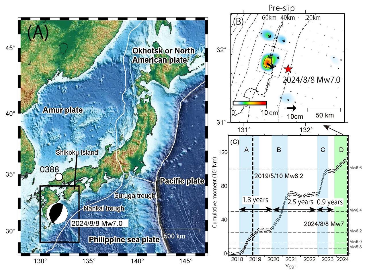

In a study published on June 26, 2025, in Science, scientists from the University of Texas at Austin recorded a slow-motion earthquake along Japan’s Nankai Trough.
The research team tracked a tectonic “unzipping” process that began about 30 kilometers inland and spread outward toward the trench over several weeks, covering more than 30 kilometers (20 miles).
“It’s like a ripple moving across the plate interface,” said Josh Edgington, who conducted the research as a doctoral student at the University of Texas Institute for Geophysics. His team used borehole sensors placed nearly 450 meters (1,500 feet) beneath the seafloor. These sensors measured movements too small for land-based GPS networks to detect.
The Nankai Trough is one of the world’s most dangerous earthquake zones. It has generated some of Japan’s deadliest quakes and tsunamis.
The same area experienced another slow slip in 2020.
This finding surprised scientists and raised new questions about other fault systems worldwide.
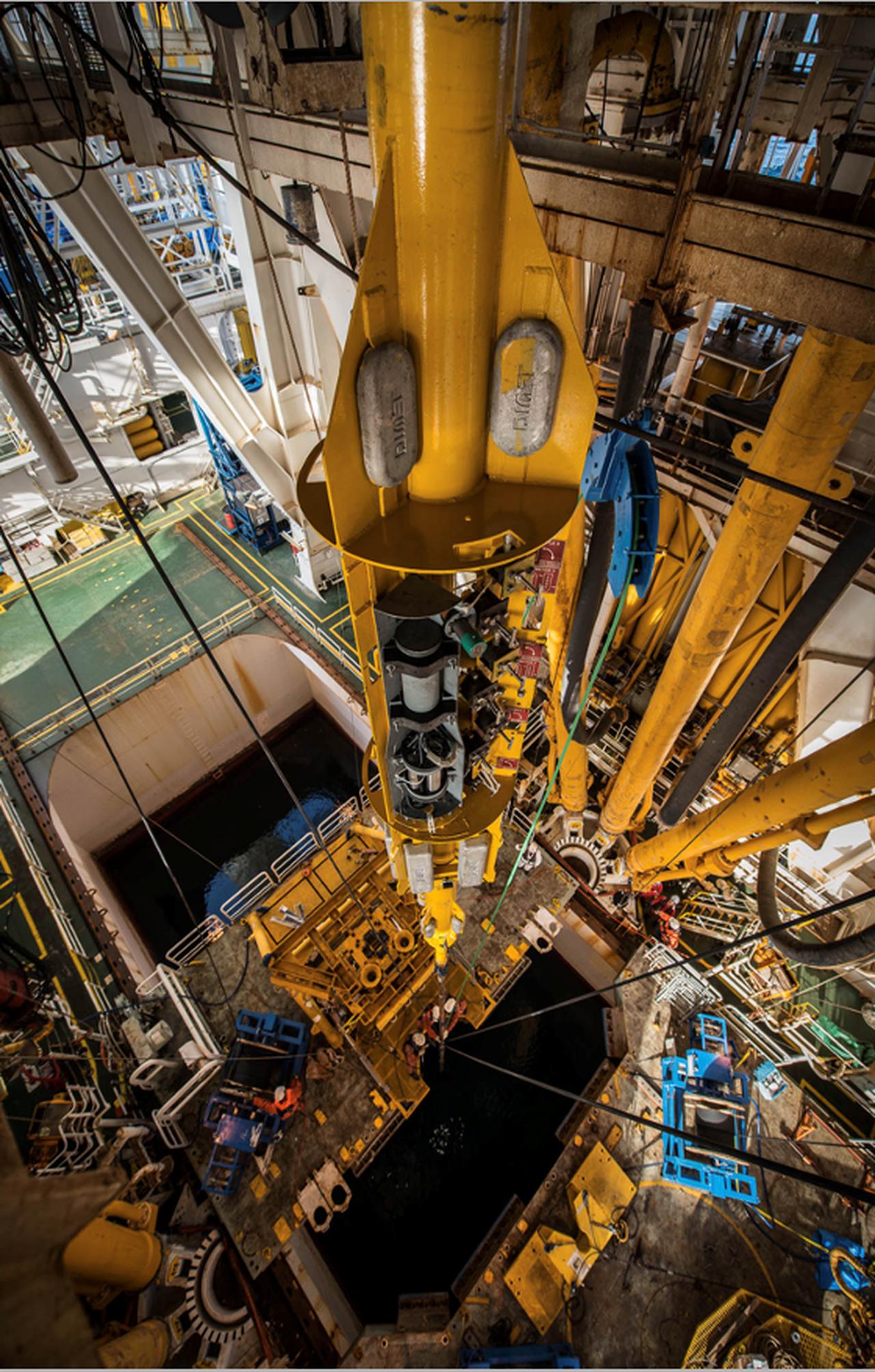
Japan was able to capture this event because it invested in deep-sea observatories years ago. The country installed pressure and movement sensors into boreholes drilled through the seabed. These observatories now transmit real-time data to earthquake scientists in Japan and at the University of Texas.
Such monitoring is not available in most parts of the world. Cascadia, the subduction zone that threatens the U.S. Pacific Northwest, does not have sensors near the trench where tsunami-generating earthquakes would start.
Demian Saffer, director of the University of Texas Institute for Geophysics and co-author of the study, told Phys.org, “Cascadia is a clear top-priority area for the kind of high-precision monitoring approach that we’ve demonstrated is so valuable at Nankai.”
The same applies to Türkiye. Large parts of the Marmara and Aegean fault systems lie offshore, but the country does not currently monitor these areas with borehole sensors. Without similar systems, Türkiye cannot detect slow slips or track changes in fluid pressure that could signal future ruptures.
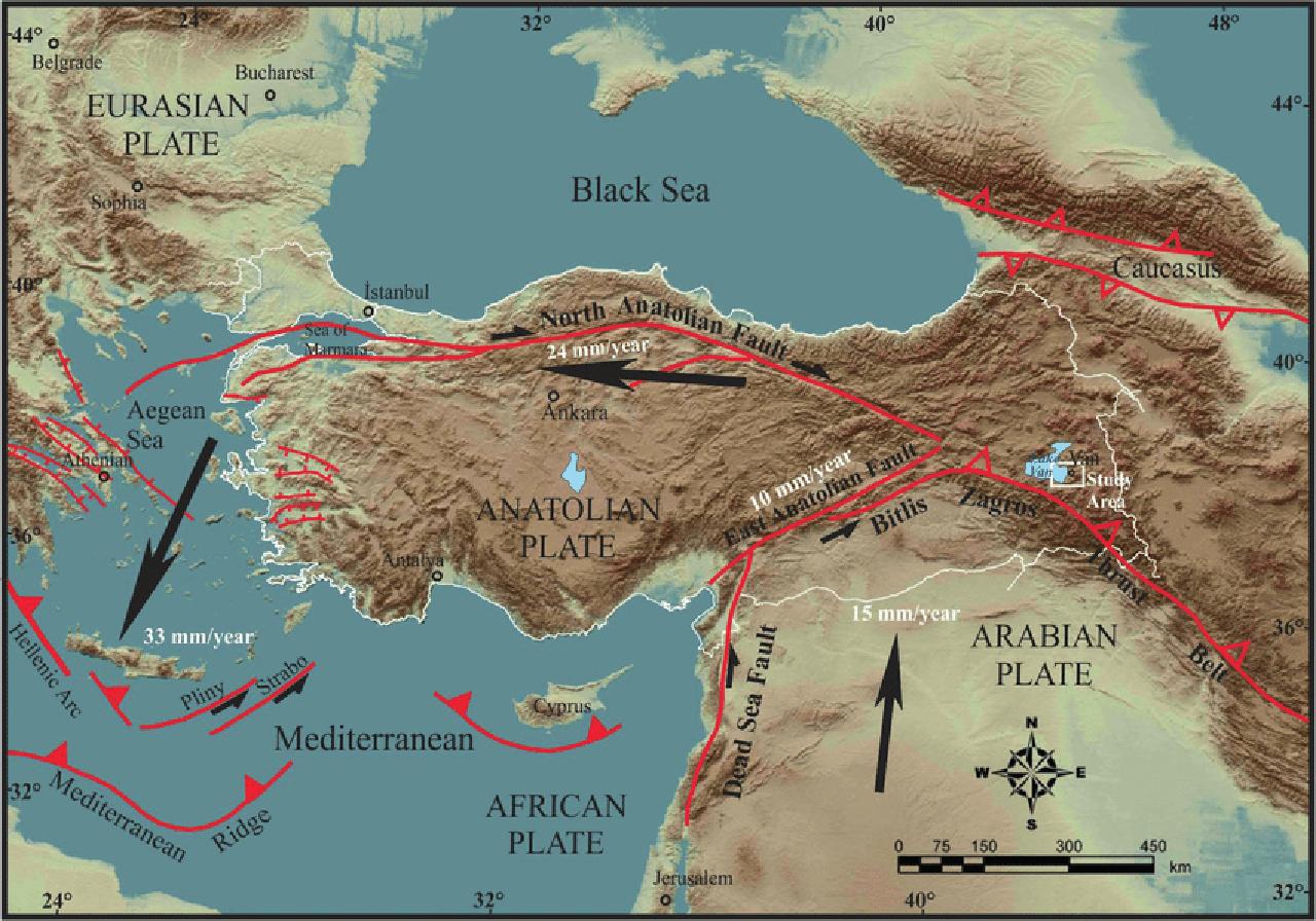
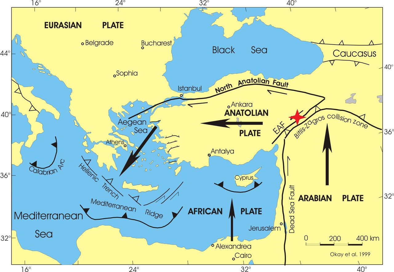
Türkiye’s North Anatolian Fault (NAF) stretches more than 1,500 kilometers (930 miles) across the country. It forms a boundary between the Eurasian and Anatolian tectonic plates. The NAF has a strike-slip structure, meaning the plates slide past one another horizontally.
According to the U.S. Geological Survey (USGS), earthquakes have moved progressively westward along the NAF for nearly a century. The fault’s recent seismic history reflects a disturbing pattern of stress transfer and rupture:
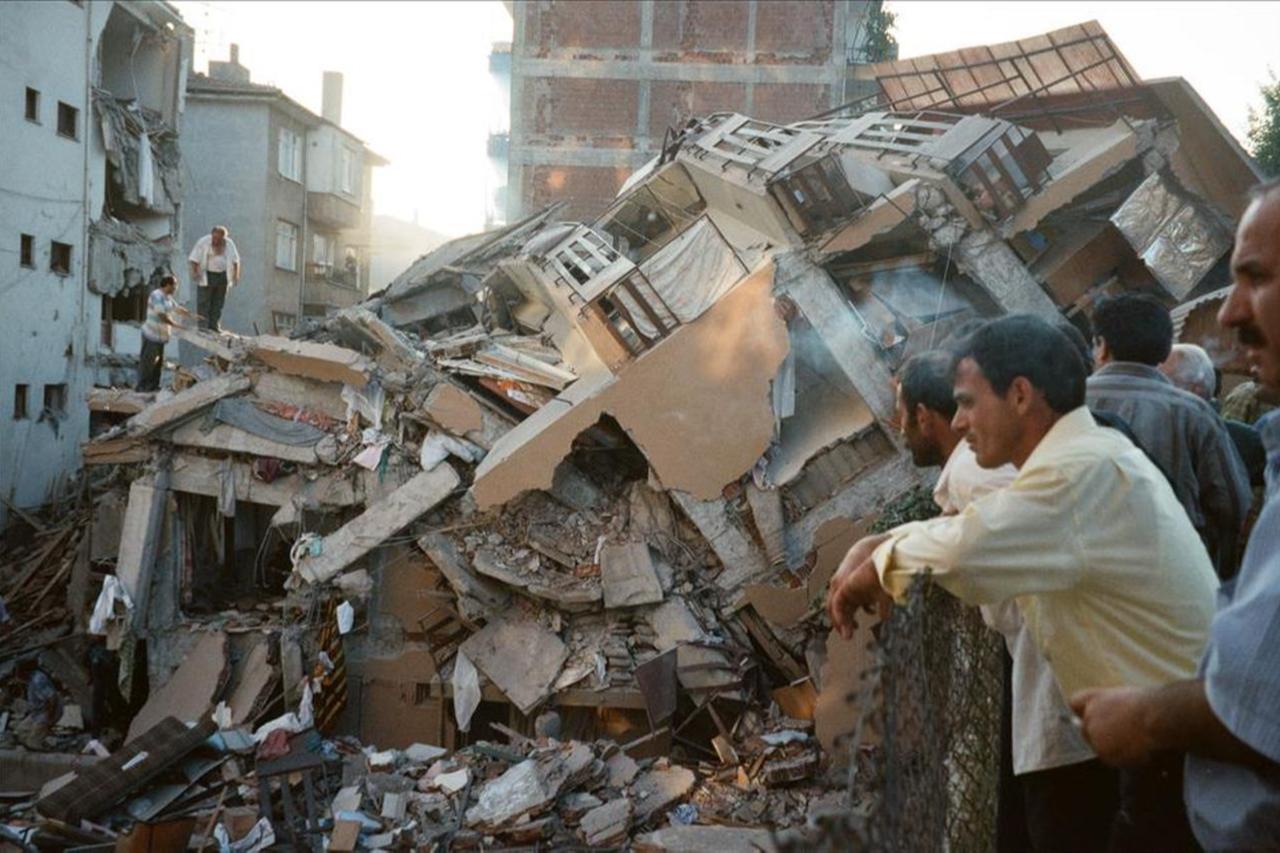
A recent article from the University of North Carolina at Chapel Hill explained the magnitude of the risk. “You would need to have 10,000 magnitude 5.1 earthquakes to release the same amount of energy as this single 7.8,” said geologist Kevin Stewart, comparing the 2023 Türkiye-Syria earthquake to minor events in the United States. “That gives you an idea of just how powerful that earthquake was.”
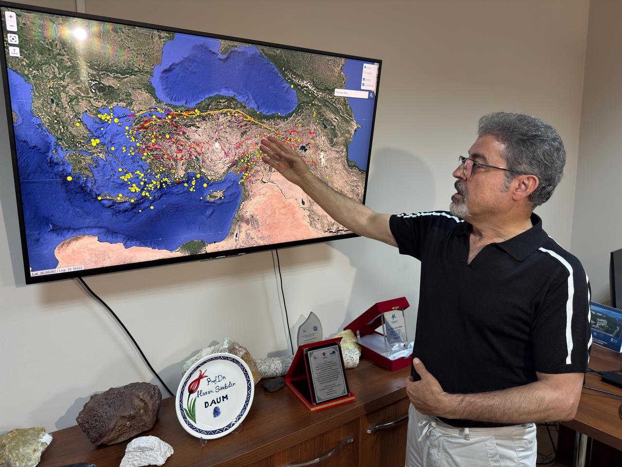
Despite the scale of the threat, seismic monitoring in Türkiye remains focused on land-based observations.
Researchers in Türkiye have made progress in mapping urban vulnerability. A 2025 study published in npj Natural Hazards used a Bayesian Best-Worst Method (BWM) to assess earthquake resilience across 961 neighborhoods in Istanbul.
The model combined 28 indicators, including population density, education levels, income, and emergency services access.
The study found an average resilience score of 0.48 on a 0 to 1 scale. Districts like Catalca and Adalar ranked highest, while Esenler and Gungoren scored lowest. Neighborhood-level data helped identify areas most in need of infrastructure upgrades and emergency planning.
However, this surface-level model does not address tectonic stress accumulating beneath the sea. The Istanbul study did not incorporate data on fault slip rates, fluid pressure, or submarine landslides. Without this information, even the best urban resilience plans can fall short when the next earthquake strikes offshore.
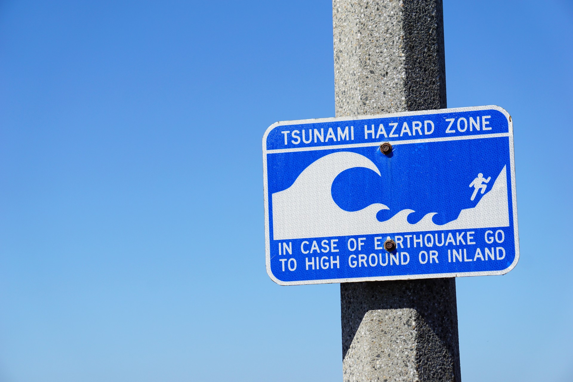
Tsunamis in Türkiye are not only historical phenomena. The country’s coastline has experienced over 80 tsunamis in the past 3,000 years, according to research by Professor Dr. Sukru Ersoy.
Many of these occurred in the Marmara and Aegean regions, where underwater basins and steep sediment slopes create conditions for dangerous wave activity.
Ersoy has documented several major events in which moderate-magnitude earthquakes triggered devastating tsunamis:
Ersoy warned that a magnitude 6.5 earthquake in the Sea of Marmara could generate a tsunami because of landslides on the steep seafloor. He noted that marine geology studies have already identified unstable sediment layers that could trigger wave amplification. Without monitoring systems in place, residents along the coast would receive no early warning.
Turkish geophysicists such as Professor Yildiz Altinok and Dr. Ahmet Cevdet Yalciner have worked with international teams from Japan and Greece to model tsunami behavior using historical sediment analysis.
These paleoseismology studies help trace the origin of past tsunamis, but they cannot provide real-time warnings.
The technology used in Japan’s Nankai study now offers a new opportunity. Borehole sensors can detect slow slip events, fluid pressure changes, and stress migrations in areas that standard GPS networks cannot monitor.
Researchers have said that combining subsurface data with urban risk models is essential for accurate forecasting.
The slow-motion earthquake captured in Japan in 2025 was not felt by anyone, but it revealed crucial information about how faults behave under pressure. By using deep-sea sensors, scientists learned that some faults can release energy gradually, without violent shaking.
This discovery has serious implications for countries like Türkiye, where large urban populations live near submarine faults that remain poorly observed.


 2 min read