Newsletters
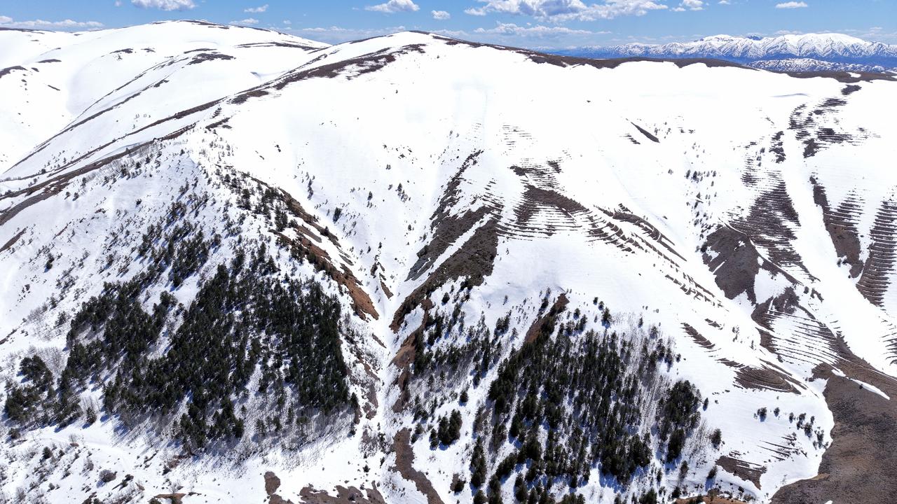
The southern slopes of Kizildag mountain in Sivas province mark the origin of the Kizilirmak, Türkiye’s longest river.
At an elevation of 2,000 meters (3.28 feet), snowmelt and groundwater collect into springs that feed a channel winding 1,355 kilometers (841.9 miles) northeast before emptying into the Black Sea at Bafra Cape in Samsun.
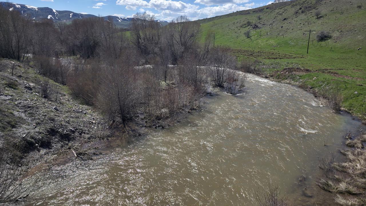
Within its first five kilometers, the Kizilirmak’s riverbed takes on a deep red hue from the iron-rich soil and rock formations of the Kizildag highlands.
The coloration intensifies after heavy rainfall, when runoff carries sediment from the surrounding slopes into the young, narrow channel near the villages of Kuzkoy and Ortakoy in the Imrali district.
The river passes through nine provinces—Sivas, Kayseri, Nevsehir, Kirsehir, Kirikkale, Ankara, Cankiri, Corum and Samsun—sustaining a range of ecosystems across central Anatolia.
Its banks and floodplains support diverse plant and animal species adapted to the shifting terrain between the arid interior plateau and the humid Black Sea coast.
Residents of the Degirmendere hamlet in Ortakoy, located at the river's source, depend on the Kızılırmak as a marker of seasonal cycles.
Cahit Bektas, who grew up in the area, told Anadolu Agency that the river flows more forcefully in years of heavy snowfall.
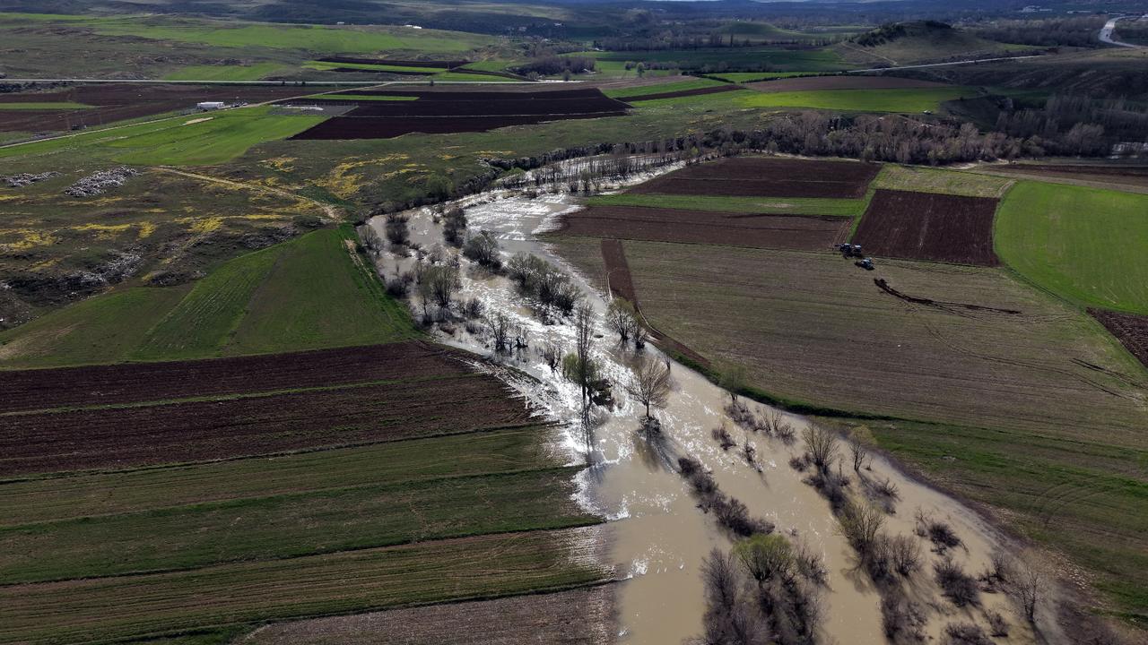
In 2025, above average rainfall and snowmelt produced higher than usual flow rates along the upper course.

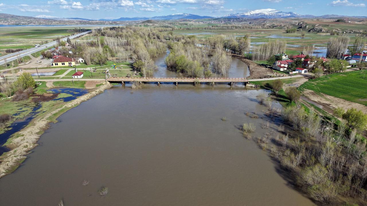
Drone footage shows how the Kizilirmak widens from a narrow mountain stream into a waterway exceeding 50 meters wide near the Zara and Hafik districts of Sivas.
The river supports agriculture, livestock, water sports and tourism along its middle and lower courses, making it a key resource for communities across the basin.
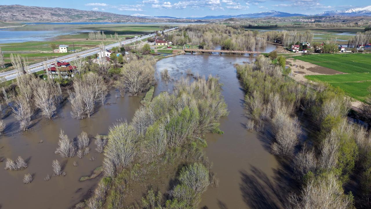
Ten dams span the main channel of the Kizilirmak, supporting hydroelectric power generation and industrial water supply.
The Koyunkaya Bridge, near the headwaters, is the first road crossing over the river, which also runs alongside the D-200 and E-88 highways near its source.


 2 min read