Newsletters


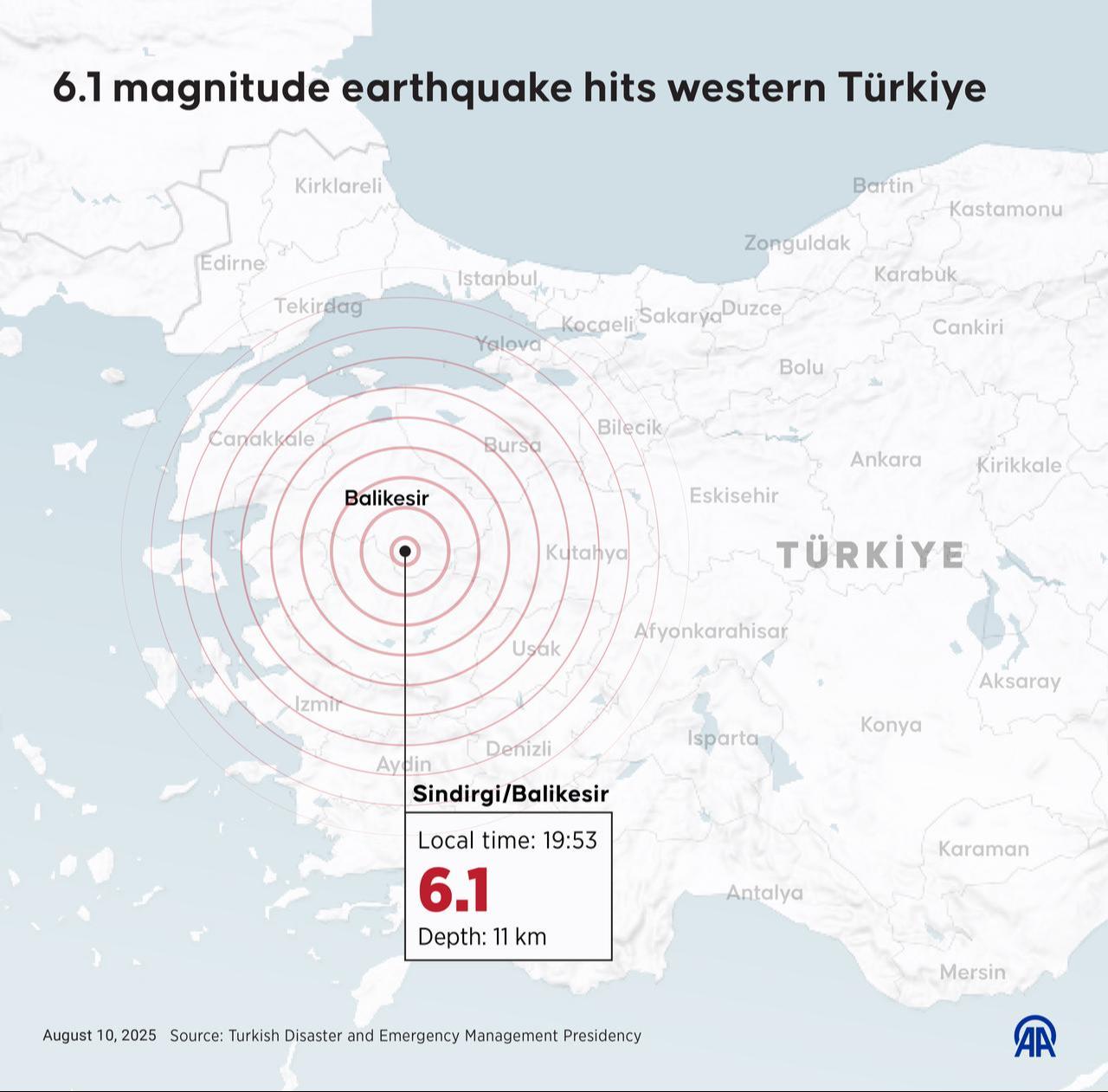
The Disaster and Emergency Management Authority (AFAD) has released a comprehensive report detailing the 6.1 magnitude earthquake that struck Sindirgi, Balikesir, on Aug. 10, and its aftermath.
At 7:53 p.m. local time on Aug. 10, a 6.1 magnitude earthquake occurred in Sindirgi, Balıkesir. The epicenter was located 0.88 kilometers from the village of Alacaatli in Sindirgi, at a depth of 12.89 kilometers. The tremor was felt across a wide area, including neighboring provinces.

Following the main earthquake, a significant number of aftershocks were recorded. Between Aug. 10 and Sept. 28, a total of 11,010 aftershocks were registered, with magnitudes ranging from 0.6 to 4.9. Among these, 44 aftershocks had magnitudes between 4.0 and 5.0.
The spatial distribution of these aftershocks was concentrated in a specific area, indicating that the seismic activity was localized along the same fault segment or within a limited region.
The report highlights that, since 1900, the region has experienced 1,464 earthquakes with magnitudes greater than 4.0, the largest being 7.2 in magnitude. This historical data underscores the seismic activity in the area and the importance of preparedness.
Following the earthquake, the Ministry of Environment, Urbanization, and Climate Change conducted damage assessments. The findings revealed that in Balikesir, 624 buildings with 901 independent units, and in Manisa, 105 buildings with 135 independent units, sustained severe damage or collapsed. In total, 729 buildings comprising 1,036 independent units were identified as heavily damaged or destroyed.
Geotechnical analyses indicated that vertical ground displacements ranging from 15 to 17 centimeters occurred in the region affected by the earthquake. These deformations were concentrated between the western segment of the Simav Fault Zone and the Gelenbe and Düvertepe Fault Zones, suggesting significant tectonic activity in the area.


 2 min read