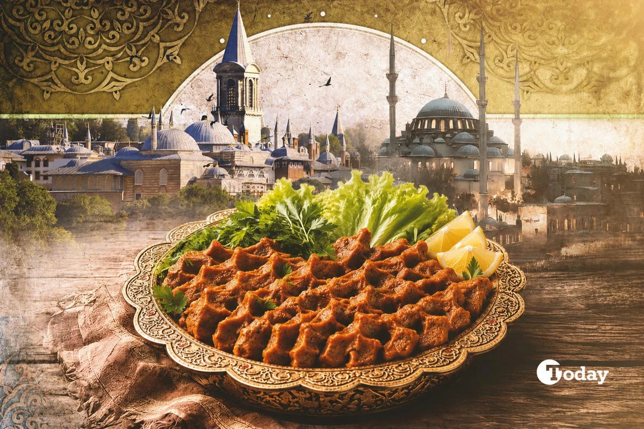
Newsletters
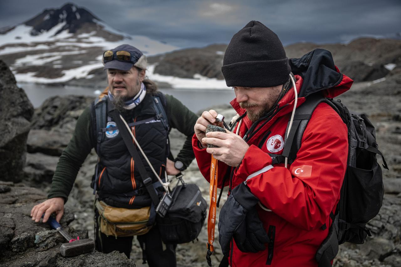


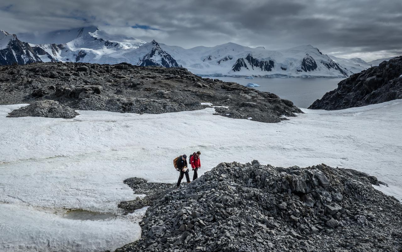
Turkish and Bulgarian geologists working on Horseshoe Island in West Antarctica are taking a closer look at rocks that could help piece together the continent’s magmatic past and broader geological evolution, as Türkiye continues its 10th National Antarctic Science Expedition under national-level patronage and in coordination with TUBITAK MAM Polar Research Institute.
Field teams from the two countries are carrying out on-site observations and sampling in harsh polar conditions, aiming to build up evidence on how Antarctica’s crust developed over millions of years and how the region’s ancient environments shifted over time. Researchers involved say the rock record they are collecting can also feed into longer-term climate research by shedding light on how dramatically the continent’s conditions have changed across geological eras.

The work is being carried out within a long-running bilateral cooperation between Türkiye and Bulgaria, with Turkish researchers based on Horseshoe Island where Türkiye has a research camp. The expedition’s deputy leader, geologist Goksu Uslular, is conducting field studies alongside Stoyan Georgiev, an associate professor from Bulgaria’s Polar Research Institute.
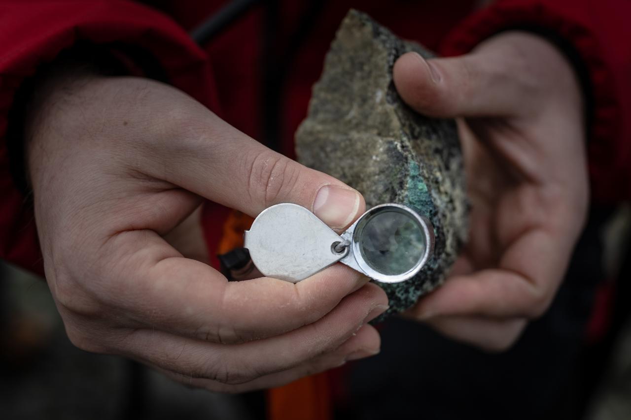
Their focus on collecting and documenting rock samples is intended to support later laboratory analyses, which they said will help firm up interpretations about how different volcanic and intrusive rocks formed, and how those processes unfolded through time.
Uslular said Antarctica was once part of Gondwana, the southern portion of the supercontinent Pangea, before separating and gradually reaching its present position. She also pointed to a major shift around 34 million years ago, when large-scale glaciation accelerated and the continent became increasingly covered by a persistent ice sheet, followed in later periods by glacier retreat and melting linked to climate variability.
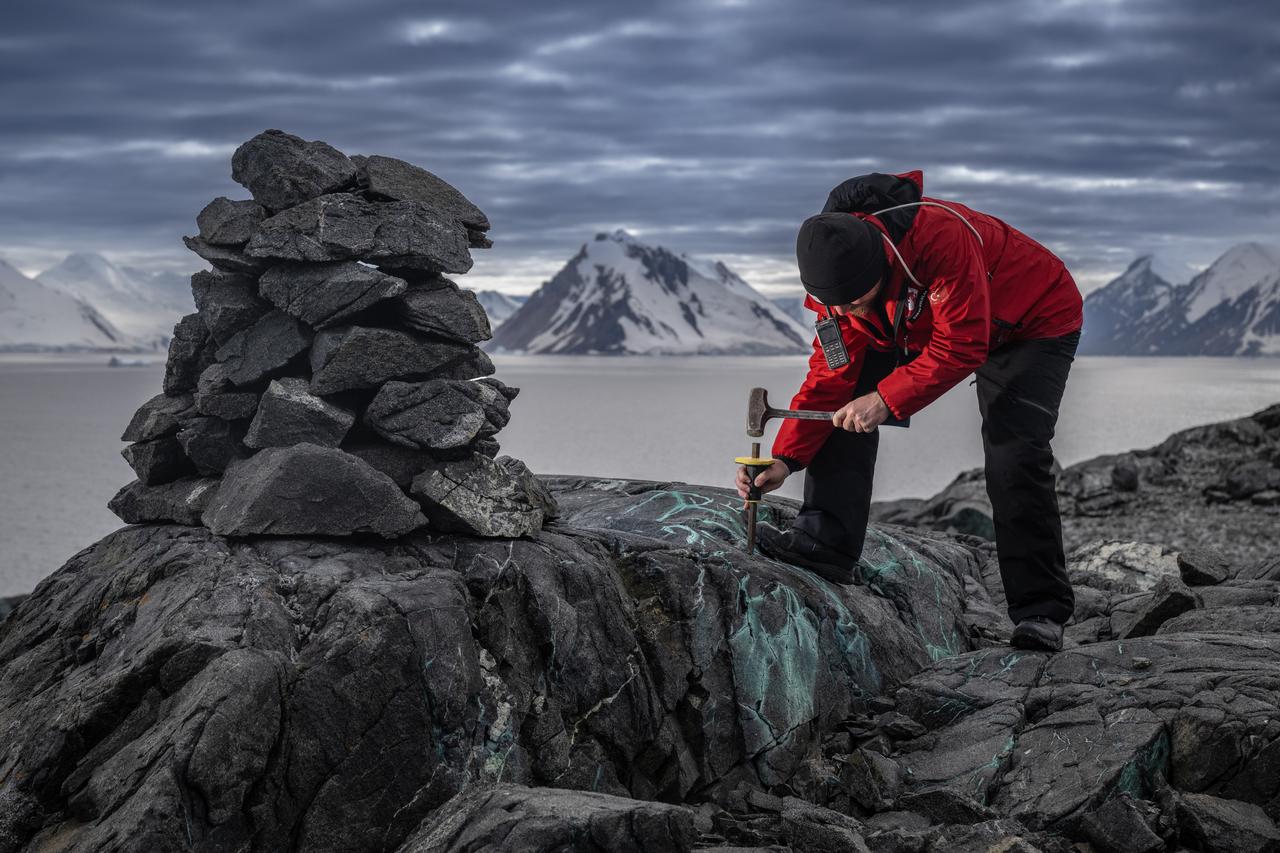
On Horseshoe Island, she said, the landscape preserves evidence of multiple magmatic phases, meaning episodes when magma formed and solidified as volcanic or intrusive rocks. She noted that Jurassic–Cretaceous magmatic rocks are widely observed on the island, alongside volcanic features such as pillow lavas, which typically form when lava erupts under water or in very shallow marine settings, as well as agglomerates and other volcanic units.
She said the team is examining the island’s volcanic rocks through field observations and sampling, and intends to build on this with detailed analyses carried out through national and international collaborations. Summing up the aim of the work, she said: “Through our studies, we aim to make important contributions to Antarctica’s geological evolution and the region’s magmatic history.”
Georgiev said they are observing some of the best exposures of gabbros that contain copper mineralization, describing visible thin veins made up of green malachite and blue azurite, which he explained as oxidation products of copper minerals. He said this surface expression points to what geologists call a shallow-level epithermal system, a type of mineral-forming environment linked to hot fluids moving through the crust at relatively shallow depths, and added that deeper levels could host primary sulfide minerals such as chalcopyrite that carry much of the copper.
He also said the island shows an unusually broad magmatic history spanning from the Jurassic period, around 176 million years ago, through the Cretaceous period, around 76 million years ago. He linked this evolution to an active subduction setting, where one tectonic plate sinks beneath another, and to slab rollback, a process in which the subducting plate retreats, reshaping magma generation and volcanic activity over time. Georgiev said the presence of multiple magmatic phases may have allowed different metallogenic characteristics to develop, referring to how and where ore-forming processes concentrate metals.
Reflecting on the bilateral cooperation on the ground, Georgiev said: “Being here with my Turkish colleagues makes me very happy, and joining this expedition is a privilege for me.”


 3 min read