Newsletters
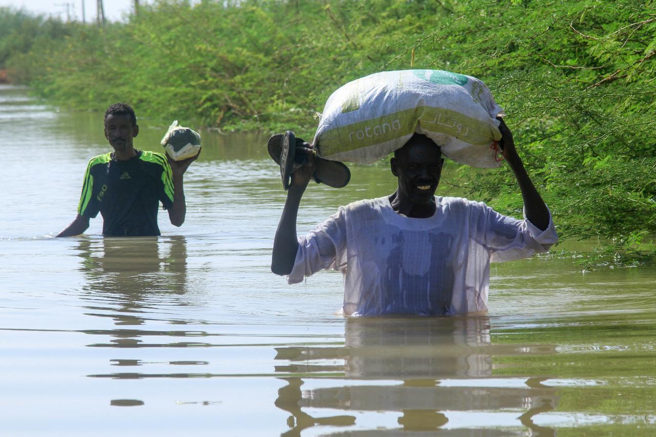


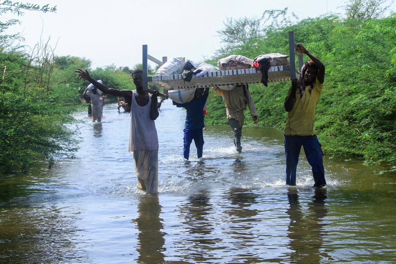
A leading dam engineering expert has warned that floodwaters currently sweeping across Sudan are expected to reach Egypt within days, raising concerns about potential flooding in areas along the Nile.
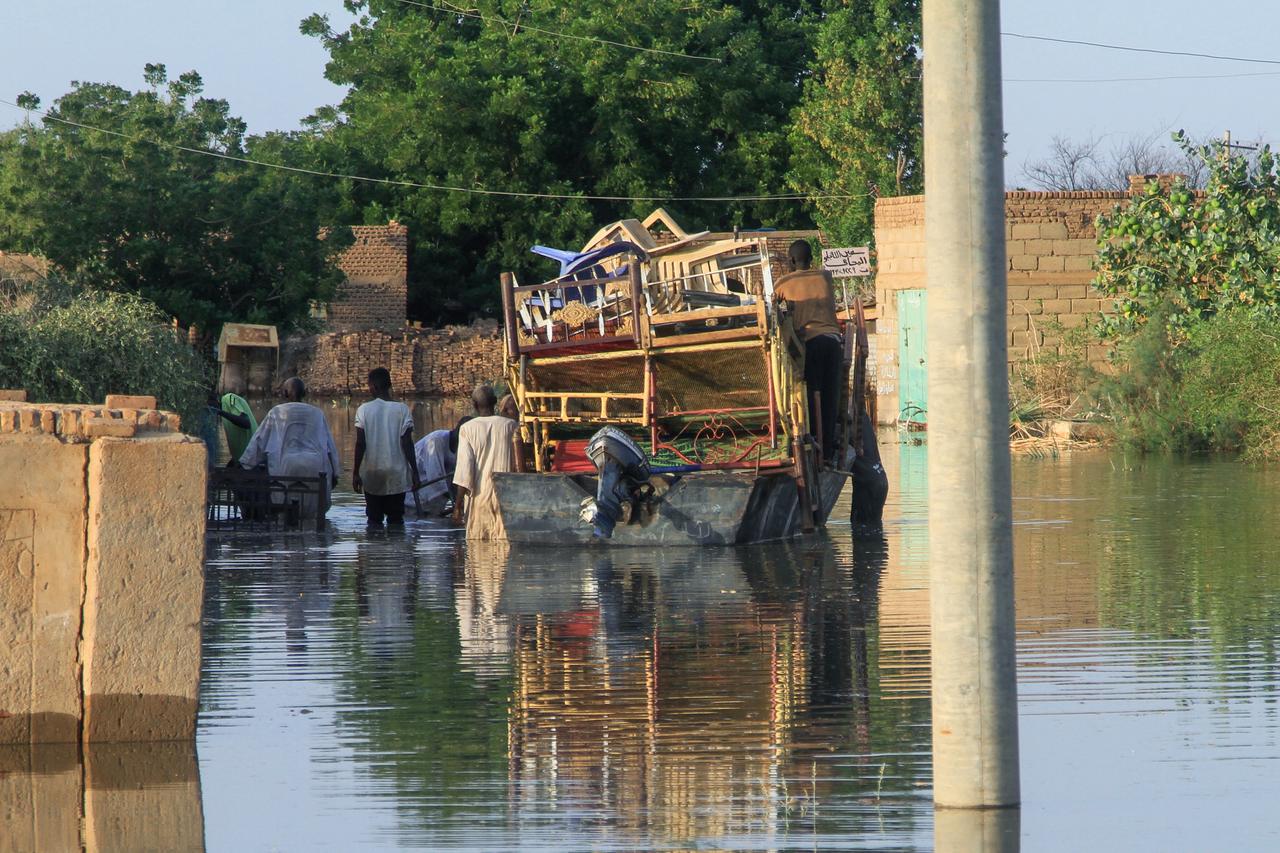
Rising water levels in the White Nile, from Lake Victoria and the Blue Nile, from the Ethiopian Highlands, have caused severe flooding in Sudan over the past week.
Following that, parts of Egypt’s Nile Delta, including Beheira and Monufia, were also affected.
Mohamed Hafez, a specialist in dam engineering , and Professor at INTI International University, Malaysia, talking to Türkiye Today, said that the flooding that struck Sudan began on Sept. 25 and continued for five days.
He suggested that Ethiopia may have played a role in the incident, citing the timing and flow patterns of the water.
“Ethiopia cannot be spared blame in this matter,” Hafez said, referring to the possible release of water from upstream reservoirs.

Following the flooding reported in the Nile Delta governorates of Beheira and Monufia, Egypt, accused Ethiopia of responsibility for the floods that struck Sudan and Egypt.
In its first official response, the Egyptian government on Friday issued a strongly worded statement. It accused Ethiopia of responsibility for the floods that struck Sudan and Egypt.
It held Addis Ababa accountable for what it described as “reckless and irresponsible actions” in managing the Grand Ethiopian Renaissance Dam.
The statement affirmed that Ethiopian policies have “caused severe damage to Sudan and pose a direct threat to Egyptian lands and lives.”
It emphasized that Cairo “will not remain idle in the face of any actions affecting its water security.”
Egypt said that Ethiopia was supposed to gradually store water in the Grand Renaissance Dam from July to October, the flood season, while releasing it year-round to generate electricity.
However, by the end of August, Egyptian authorities observed that Ethiopian operators had deviated from established technical and scientific norms.
Hafez explained that the floodwaters have not yet reached Egypt’s Lake Nasser, the massive reservoir behind the Aswan High Dam.
Hafez explained that the recent flooding that submerged parts of the Nile Delta resulted from the Ministry of Irrigation’s decision to close the Toshka Spillway on Sept. 11.
He noted that the spillway serves as the first line of defense for Lake Nasser, adding that Egypt had not experienced similar floods in previous years because excess water was typically diverted to Toshka.
“The water flowing from the Roseires Dam in Sudan takes about 15 days to reach Lake Nasser,” he noted, indicating that the waters from the late September floods are expected to arrive around October 10.
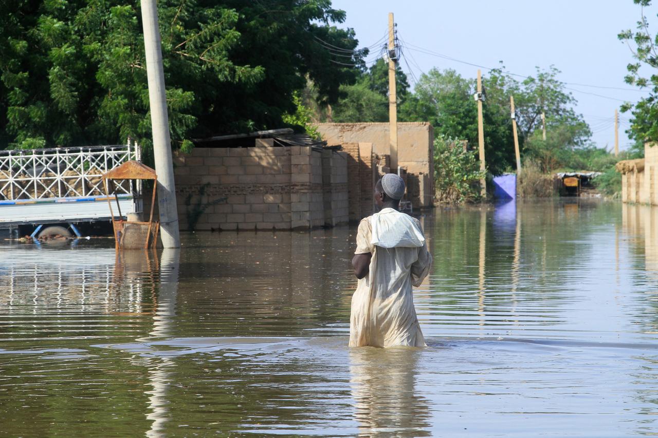
Large swaths of agricultural land and several homes were submerged after river levels rose and breached their banks.
Among the most affected areas are the so-called “riverbank lands,” or Tahr al-Nahr, low-lying zones located within the Nile’s floodplain.
These areas are particularly vulnerable to submersion when water discharge levels increase.
Authorities in Egypt are reportedly monitoring water flows closely and preparing for potential impacts as the floodwaters move downstream toward Lake Nasser and beyond.
Hafez stressed that the recent and potential future floods could be avoided through clear operational policies and agreements between the countries involved.
"Ethiopia committed two critical errors that reveal its true stance toward Sudan, beyond media narratives," Hafez said.
The first error involved keeping the western spillway gates closed during the sixth filling phase, preventing any flow until the reservoir reached full capacity on Sept. 9, 2025.
Opening just one gate to release about 200 million cubic meters of water per day from early July could have reduced pressure on the Roseires Dam.
Delaying the dam’s inauguration until late September or early October might have prevented over 85% of the current flooding.
The second error was allowing the release of around 2 billion cubic meters of water in fewer than five days.
This, combined with the regular daily flow toward the Roseires Dam, raised discharge levels to about 750 million cubic meters per day instead of the expected 400 million.
Experts stress that both actions were driven by political motives rather than technical considerations.
Given that the Grand Renaissance Dam is about ten times larger than the Roseires Dam, poor coordination between them could have threatened the Roseires Dam’s stability—a risk Ethiopia overlooked.
Experts warn that the Grand Renaissance Dam’s proximity to the Roseires Dam—about 110 kilometers—makes the lack of daily data exchange a major operational risk.
In July 2020, Khartoum’s drinking water stations halted for days due to no notification during dam filling, showing the system’s sensitivity to sudden water releases.
Cross-border management frameworks stress that poor coordination harms countries along the Nile, while cooperation reduces risks to water and energy supplies by adjusting operations to the new dam.
Simulation studies suggest a catastrophic flood could submerge Khartoum and damage the Roseires and Sennar dams. Meroe could remain operational if the emergency spillway is used.
While unlikely, such events would have severe consequences, requiring joint emergency plans, early warning systems, and regular dam safety drills.
Experts say the flooding risk in Sudan is tied to the Grand Renaissance Dam and depends on how it’s operated and coordinated among countries.
Scientifically, the dam can reduce the risk of riverine floods in Sudan if operated cooperatively with data sharing among parties.
However, the risk increases in the absence of coordination or under low-probability, high-impact emergency scenarios, such as dam failures.
Therefore, the issue cannot be dismissed as mere media exaggeration, nor is it entirely risk-free; it relies on operational rules, coordination with the Rosires Dam, and the region’s early warning infrastructure.


 3 min read