Newsletters


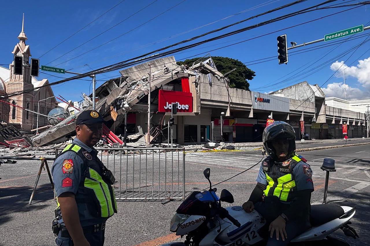
A powerful 8.8 magnitude earthquake recently struck off the eastern coast of Russia’s Kamchatka Peninsula, shaking the ground 119 kilometers (73.94 miles) southeast of the city of Petropavlovsk-Kamchatskiy.
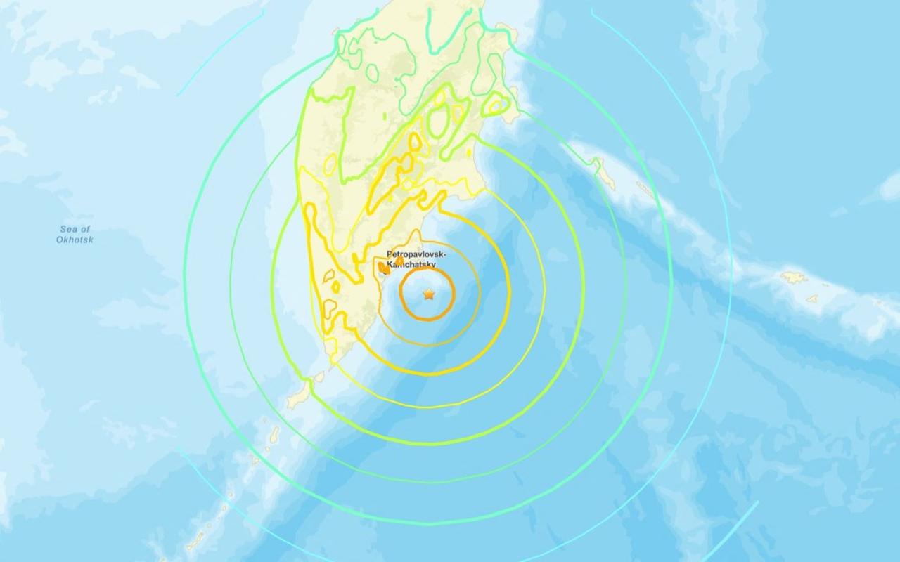

According to the United States Geological Survey (USGS), the earthquake originated at a depth of 20 kilometers, triggering immediate tsunami warnings. Several aftershocks, including tremors measuring 6.9 and 6.3 in magnitude, were also recorded in the region.
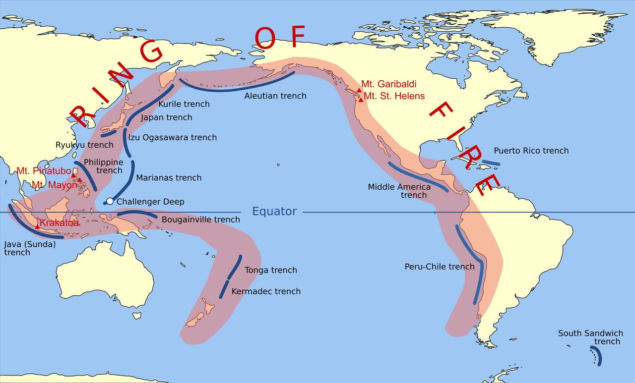
This seismic activity highlights the persistent risk in the Pacific Ring of Fire—a massive horseshoe-shaped zone of high seismic and volcanic activity that circles the Pacific Ocean. This zone is responsible for about 90% of the world’s earthquakes and nearly 80% of the largest ones.
The 10 most powerful earthquakes in recorded history have largely taken place in countries along the Pacific Rim, including Chile, Japan, Indonesia, and the United States. The Ring of Fire stretches for roughly 40,000 kilometers from South America’s southern tip, up the western coasts of North and Central America, across the Aleutian Islands, and down through Japan, the Philippines, and New Zealand.
Volcanoes and tectonic plate boundaries define the zone, which includes three-quarters of the world’s active volcanoes.
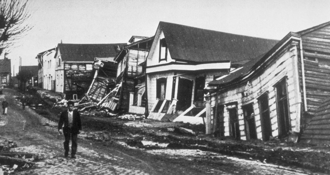
The strongest earthquake ever recorded struck Chile’s Valdivia region on May 22, 1960. With a magnitude of 9.5, it was felt across a 1,000-kilometer radius. The disaster claimed 1,655 lives and left 2 million people homeless. A tsunami generated by the quake reached as far as Hawaii, Japan, and the Philippines, killing nearly 230 people outside Chile.
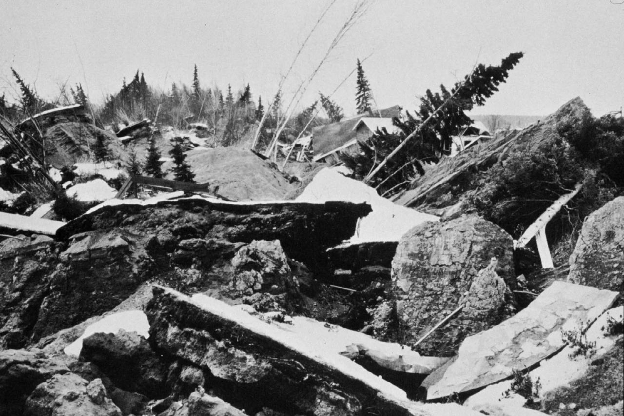
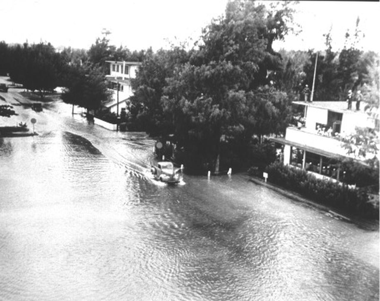
The second-largest earthquake occurred in Alaska on March 28, 1964, measuring 9.2 on the magnitude scale. It lasted about three minutes and caused a deadly tsunami. While 128 lives were lost, the low death toll for such a powerful event was considered remarkable.
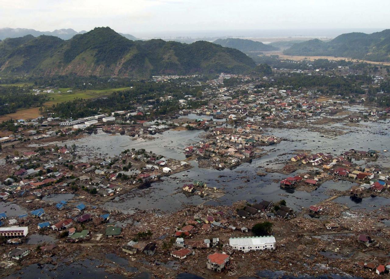
On Dec. 26, 2004, the Indian Ocean was rocked by a 9.1 magnitude earthquake off the coast of Sumatra, Indonesia. The shaking lasted nearly 10 minutes, producing tsunamis that devastated 14 countries and caused approximately 230,000 deaths. Around 1.7 million people were displaced, making it one of the deadliest natural disasters in history.
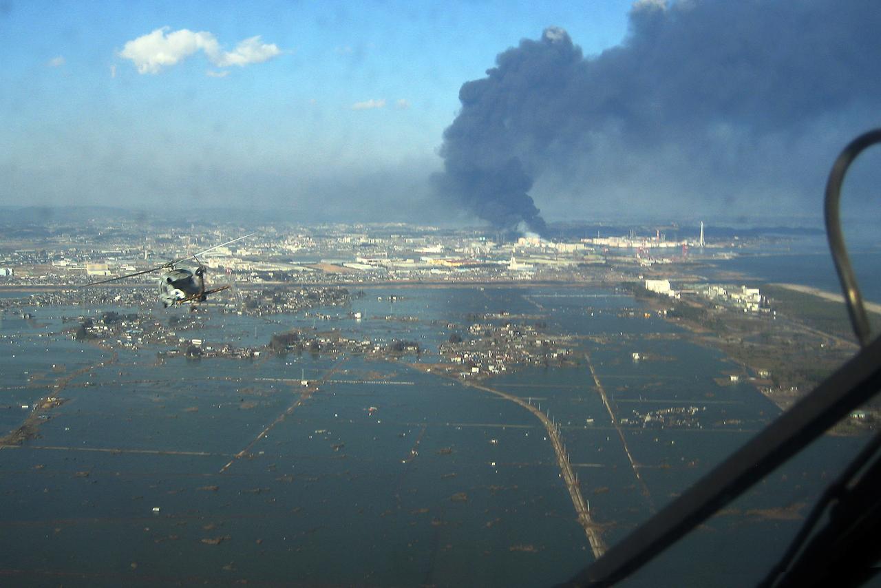
Japan experienced its most powerful quake on March 11, 2011, when a 9.0 magnitude earthquake struck near Sendai. It generated a tsunami that left nearly 19,000 people dead or missing and triggered a major nuclear accident at the Fukushima plant.
Another significant event occurred in Kamchatka on Nov. 4, 1952, with a 9.0 magnitude earthquake that led to tsunamis reaching Hawaii. Although there were no casualties, the disaster caused around $1 million in damage.
Other major quakes include the 2010 Chilean earthquake (8.8 magnitude), the 1906 Ecuador-Colombia event (8.8), the 1965 Rat Islands earthquake in Alaska (8.7), a second Sumatra quake in 2005 (8.6), and the 1950 Assam-Tibet quake (8.6), which triggered deadly landslides and widespread destruction across parts of India and China.
While the Pacific Rim hosts the majority of the world’s seismic activity, a second major earthquake belt—the Alpide Belt—stretches from Indonesia through the Himalayas, across Türkiye and the Mediterranean, and into the Atlantic. Türkiye, located along this fault line, is among the most earthquake-prone regions in Europe.
In North America, the most active zones include the western coastal areas from British Columbia down to Baja California and inland Alaska. Central America, from Puerto Vallarta in Mexico to the Pacific coasts of Guatemala and Costa Rica, also faces frequent seismic activity.
In Asia, tectonic shifts are concentrated around the Indonesian archipelago and Japan, both located between major continental and oceanic plates. Central Asia also experiences regular movement, particularly from the eastern Black Sea down through Iran and Pakistan.
Africa sees relatively low seismic activity, with exceptions in regions like the East African Rift near the Horn of Africa. Europe’s seismic hotspots are mostly confined to the Mediterranean zone and parts of southeastern Türkiye. Meanwhile, Australia experiences fewer and milder earthquakes, unlike its neighbor New Zealand, which lies along an active fault.
Antarctica remains the least seismically active continent. However, a small exception exists where the Antarctic Plate meets the Scotia Plate near the southern tip of South America.


 2 min read